While they aren't the complete body due to size, they are of important rock areas of the lake and rocks are key to finding walleyes on Devils Lake.
These are large files so I suggest not trying them in Elite HDI/Chirp, Hook, Hook2, or HDS Gen 1 because of the units limited maximum resolution. The HDS Live, Elite Ti2, Carbon and HDS Gen 3 , Live and Carbon are beyond compare.
HDS Live & Carbon
HDS Gen 1-2-3
Elite TI TI2
At this time the maps do not work in the Hook2 units. If and when in the future they will we will let everyone know.

The areas that are covered with have red outline over the contours.
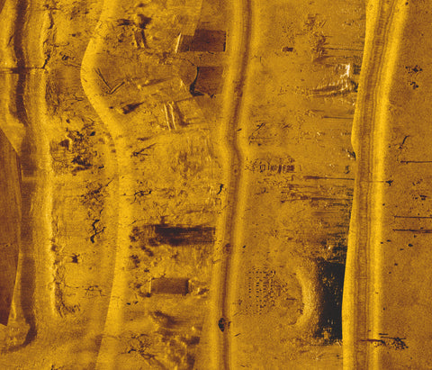
And you can scan in to resolutions you won't believe. In the corner of this image you can see it's scale is set 30 ft, but if you wanted to you could go 20ft.

This is going to be like running your side scan in your boat without being in a boat. Ice fishing to a couple levels higher you might say.
Watch this video to see how it works and why it is valuable.
.